

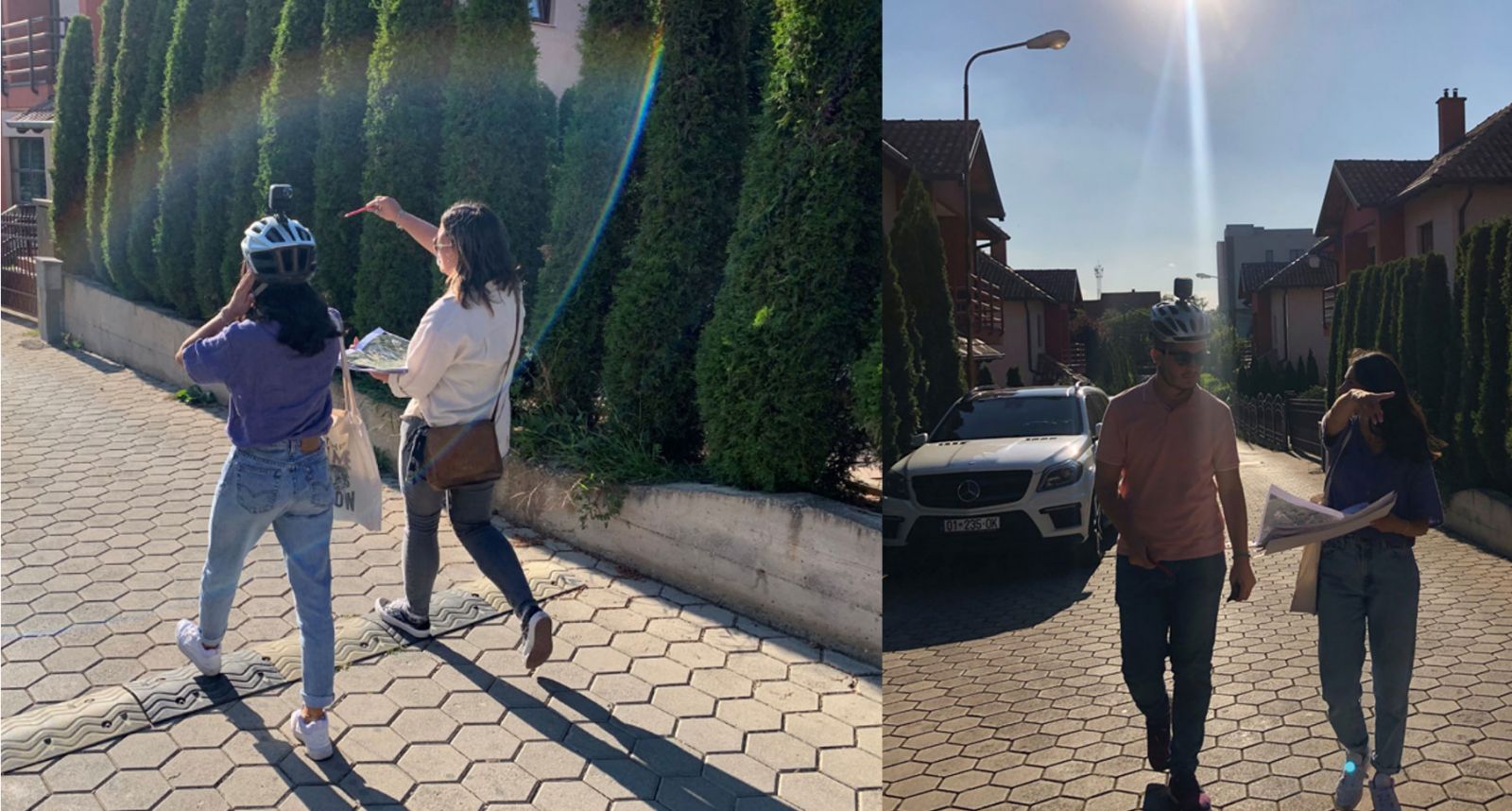
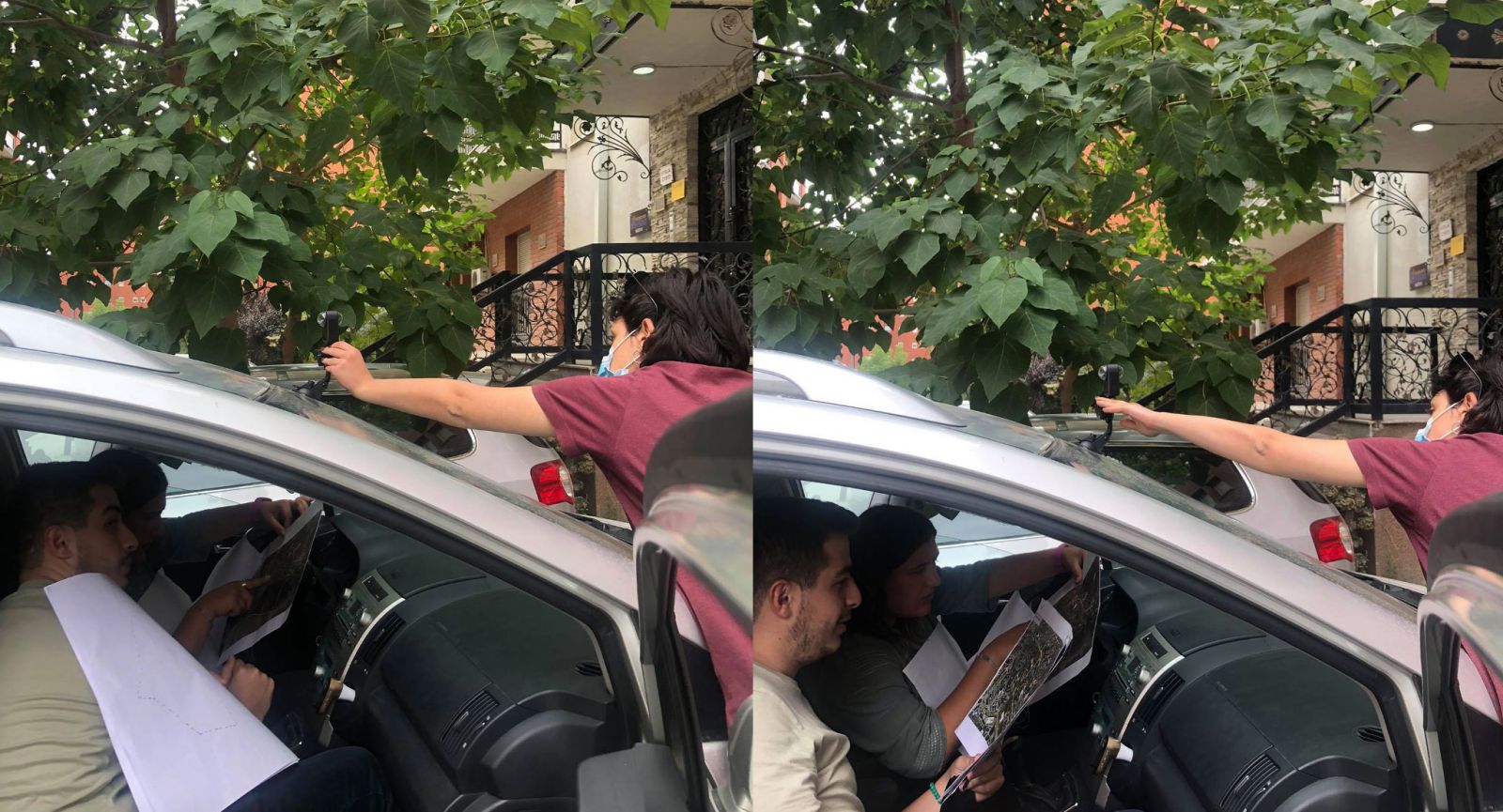
Bottom-up Street View: Data collection strategy for crowdsourcing street view imagery in Pristina, Kosovo
Bottom-up Street View aims to create guidelines for the citizen-led collection of street view imagery. The City of Prishtina was selected as a case study given that it remains relatively unexplored by Google Maps’ Street View. In response to the rising pressure of urbanization following Kosovo’s civil war, Prishtina green spaces were largely paved over, leaving an impervious, artificial landscape. The proposed guidelines will cater to pedestrians and cyclists, exposing public spaces such as parks and pedestrian areas that are often omitted from Google Maps’ Street View.
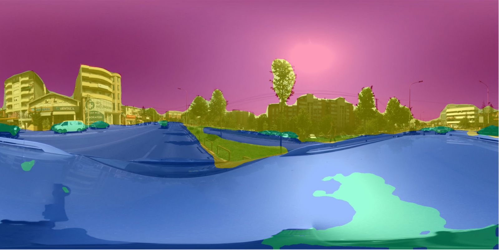
Google Maps’ Street View App will be used to georeference, post-produce and access street view imagery dataset.
Why is street view imagery important?
- Wayfinding tool: more immersive, human-scale alternative to satellite imagery
- Economic tool: greater visibility for street-front businesses
- Research tool: important data set for street-level urban form analysis
Opportunities offered by crowdsourced approach:
- Alternative or complementary solution to google-owned content
- Engage with citizens through gamification
- Customize data collection guidelines for new perspectives on the city (such as urban green)
- Regular or near-real-time updates could expand street-level analysis from static elements (such as urban form) to dynamic elements (such as human behavior)
The overall goal of the project is to crowdsource a complete database of street view imagery for the analysis of urban green in Prishtina.

This work was developed by CRA in parallel to the Manifesta 14 Urban Study project. The Manifesta 14 urban study receives funding from the EU under the Creative Europe Programme (CREA), and agreement 623258-CREA-1-2020-1-NL-CULT-COOP-WB
- X Li, C Zhang, W Li, R Ricard, Q Meng, W Zhang (2015).
Assessing street-level urban greenery using Google Street View and a modified green view index.
Urban Forestry & Urban Greening 14 (3), 675-685
- I Seiferling, N Naikc, C Ratti, R Proulx (2017).
Green streets − Quantifying and mapping urban trees with street-level imagery and computer vision.
Landscape and Urban Planning 165: 93–101
- X Li, C Ratti (2018).
Mapping the spatial distribution of shade provision of street trees in Boston using Google Street View panoramas.
Urban Forestry & Urban Greening 31: 109-119
- Zhang, F., Zu, J., Hu, M., Zhu, D., Kang, Y., Gao, S., Zhang, Y., Huang, Z. (2020) .
Uncovering inconspicuous places using social media check-ins and street view images
Computers, Environment and Urban Systems , 81, 1-14.
- Ghahramani, M., Galle, N., Duarte, F., Ratti, C., Pilla, F. (2021) .
Leveraging artificial intelligence to analyze citizens’ opinions on urban green space
City and Environment Interactions, 10, 1-9.
- Kai Vockler. (2008)
Prishtina Is Everywhere. Turbo Urbanism: The Aftermath of a Crisis
- UN-Habitat Kosovo. (2017)
Public Space Profile Prishtina
- UN-Habitat Kosovo. (2019)
Prishtina Public Spaces
- Treepedia Project by Senseable City Lab
http://senseable.mit.edu/treepedia
- Diversitree Project by Senseable City Lab
https://senseable.mit.edu/diversitree/
Authors:
- Emma Greer
- Juan Carlos Romero
- Alberto Benetti
- Erze Dinarama
- Daniele Belleri
Exploratory: Sustainable Cities of Citizens
Sustainable Goals:
- Sustainable Cities and Communities
- Industry, Innovation, and Infrastructure
- Climate Action